
This map provides a first attempt at visually representing the movements and settlements of Jesuits and women’s congregations after the restorations (including the Restoration of the Society of Jesus [1814]) following the Napoleonic era. The story is largely one of crossings and dwellings: crossing boundaries — geographical, national, ethnic, linguistic, cultural, neighborhood — and setting up dwellings with varying degrees of stability.

The story begins in Europe and the narrative hinges on the fluidity of the boundaries there. The central position played by emigres from the Low Countries — present-day Netherlands and Belgium — has its roots in the instability of state formations and identities following the collapse of Napoleon’s occupations. Similarly, the constantly shifting fortunes of France — the Revolution’s dechristianization campaign; Napoleon’s empire; the Louisiana Purchase of 1803; and the church-state struggles that followed Napoleon’s fall throughout the 19th century — played a strong causal role in sending French religious congregations abroad. Analogous political struggles in territories that would eventually unite to form Germany and Italy provided similar causal factors, especially during the turbulent period following the revolutions of 1848 and the Kulturkampf [culture-struggle] in Bismarck’s nascent empire. Meanwhile, the building of the Illinois & Michigan Canal (1836-1848) lured numerous Irish immigrants to the Chicago region, a migration augmented by the great Irish famine that began in 1845.

The second cluster of crossings and dwellings is located in the Midwest, first in the St. Louis area and then in Chicago. The centrality of water in this story is made visually clear: the Atlantic ocean, the ports of New Orleans and St. Louis on the Mississippi River, Lake Michigan, and eventually the I & M canal uniting the river and great lake.
Florissant, a present-day suburb of St. Louis, is the place where both Pierre Jean De Smet and Rose Philippine Duchesne make their initial Mississippi River dwellings. Initially, it is a space both liminal and hybrid: part-European (Flemish and French) and part “American.” (Indeed, one of Duchesne’s abiding problems throughout her life was difficulty with mastery of the English language.) This is the initial “frontier” between “Europe” and “America.”
However, the liminality is even stronger when we consider that De Smet’s initial foundation at Florissant was a seminary school for American Indian boys. Now the “frontier” shifts in meaning: it signals the boundary between “America” and “indigenous” even as it remains the border area between “Europe” and “America.”
Moreover: Duchesne’s establishment of her free school for girls — first in Florissant and then migrating to St. Louis — stands as a boundary marker of gender in the evolution of women’s education in America. It is only the initial planting of what will become a vast educational network of the emigrant French “Madames of the Sacred Heart” (RSCJs) serving immigrant girls and boys.
Florissant, then, is a complex space — in terms of ethnicity, culture, language, religion, gender, and (inter-)national identity — in which Europe, evolving “America,” and indigenous tribes interact in improvised ways.
Looking westward, De Smet’s travels to northwest territories and (trans-nationally) into Canada make of him a portable “frontier.” De Smet’s westward explorations are remarkable enough; but they become even more complex when we consider that during this same time he made at least sixteen return voyages to the Low Countries in order to raise funds to support his various ventures (including the establishment of Saint Louis College, later University, first presided over by founded by fellow “Belgian,” Peter Verhaegen). From De Smet’s perspective, Saint Louis was more than a base of operations: it continued to be an ever-evolving frontier between Europe, America, and indigenous peoples.

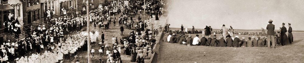
Finally, Arnold Damen, emigre from the Netherlands, is educated at Florissant, serves as pastor at the college church of St. Louis College, and moves on to Chicago. In spite of his thick Dutch accent, he achieves fame as an eloquent English-language orator and preacher. He will build massive institutions — Holy Family Church (the “cathedral on the prairie”) and St. Ignatius College, both situated at the outermost boundary of Chicago’s urban limits (present-day W Roosevelt Rd) — in order to serve the Irish immigrants who work on the canal and live outside the city. He will voyage to Europe in order to raise funds for this Anglophone mission from Dutch philanthropists; and his institutions will become “inner-city” locations as new Irish immigrants swell into the area and establish their dwellings. The city will continue to incorporate “prairie” space and expand its boundaries. Eventually new boundaries will be crossed as Loyola University is formed out of St. Ignatius College and relocates to the city’s northernmost limits in Rogers Park on Lake Michigan’s shore. These outermost urban extremities will eventually evolve into present-day “inner-city” neighborhoods.
This same intra-urban migration will happen when the ever-growing St. Louis University moves away from the river out to the city’s westernmost limits — today’s present-day midtown.
Although only a beginning, this map is a first attempt at representing the fluidity always in motion that pulses beneath the narrative of “Restored Jesuits and the American Experience”: a story of crossings and dwellings.